
|
| Yanco Study Area |
|
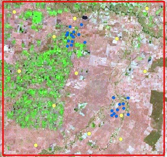
Yanco Study Area The Yanco study area is a 60km x 60km square area to the south and west of the Yanco Research Station. It is gently sloping and contains much of the Coleambally Irrigation District. The Murrumbidgee River is immediately to the north of the area. There are 37 soil moisture sites distributed across the Yanco study area. However the blue highlighted Sites have a different Instrumentation compared to the yellow ones. To view information regarding the observation sites click on the image to the right. To view the different observations available click the titles above the image. To view different surface overlays click the titles below the image.
|
|